Rugged Routes product development is currently a high priority, and therefore enquiry e-mails are delayed. For urgent orders and tight deadlines, please call 909-547-4651 or schedule a meeting here: Schedule Meeting
Thank you,
-Steven
Get the comprehensive Getting Started Guide:
**For Lowrance HDS & Elite FS GPS Units**
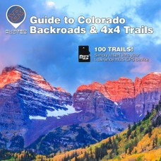
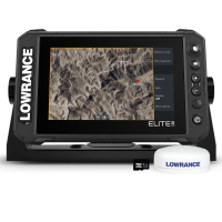
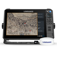
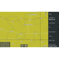
This SD card includes high definition aerial imagery of trails for use in your Lowrance HDS GPS system. This mapping system should be used in conjuntion with the FunTreks Guidebook Series. Maps include Trailhead information, waypoint details and trail traces for 100 different trails.
- Last Dollar Road (E)
- Yankee Boy Basin (M)
- Governor Basin (D)
- Imogene Pass (M)
- Black Bear Pass (D)
- Porphyry Gulch (M)
- Ophir Pass, Alta Lakes (M)
- Clear Lake, Bandora Mine (E)
- Mineral Creek (D)
- Poughkeepsie Gulch (D)
- Corkscrew Gulch, Hurricane Pass (E)
- Red Mountain Mining Area (E)
- California Gulch (E)
- Engineer Pass (M)
- Cinnamon Pass,Wager Gulch (M)
- Picayune & Placer Gulches (M)
- Eureka Gulch (E)
- Kendall Mountain (M)
- Arrastra Gulch (M)
- Stony Pass, Kite Lake (M)
- Lead King Basin (D)
- Devil’s Punchbowl (D)
- Paradise Divide (E)
- Aspen Mountain, Richmond Hill (M)
- Lincoln Creek Road (M)
- Montezuma Basin (D)
- Pearl Pass (D)
- Taylor Pass (D)
- Italian Creek, Reno Divide (M)
- Fourmile Area (E)
- Chinaman Gulch Carnage Canyon (D)
- Mt Princeton (M)
- Mt Antero, Browns Lake (D)
- Baldwin Lakes, Boulder Mountain (M)
- Grizzly Lake (D)
- Iron Chest Mine (D)
- Pomeroy Lakes (D)
- Tincup Pass, St Elmo (M)
- Hancock Pass, Alpine Tunnel (M)
- Tomichi Pass (D)
- Taylor Mountain (M)
- Billings Lake (E)
- Marshall Pass via Poncha Creek (E)
- Rawley Mine, Bonanza (M)
- Shrine Pass (E)
- McAllister Gulch (M)
- Slide Lake, Wurts Ditch, No Name Gulch (M)
- Holy Cross (D)
- Mount Zion (E)
- Hagerman Pass (E)
- Chalk Mountain (E)
- Mosquito Pass (M)
- Birdseye Gulch (D)
- Halfmoon Gulch (D)
- Wheeler Lake (D)
- Lower Mt Bross (E)
- Breakneck Pass & Browns Pass (M)
- Weston Pass (E)
- Lost Canyon (M)
- Spring Creek (D)
- Cascade Creek (M)
- Saxon Mountain (M)
- Barbour Fork (D)
- Devil’s Canyon (M)
- Argentine Pass, McClellan Mtn (M)
- Keystone Gulch (E)
- Peru Creek (E)
- Chihuahua Gulch (M)
- Santa Fe Peak (M)
- Deer Creek, Saints John (M)
- North & Middle Fork of the Swan River (M)
- Radical Hill (D)
- Webster Pass, Handcart Gulch (M)
- Red Cone (D)
- Georgia Pass (M)
- Peak 10 Breckenridge (M)
- Boreas Pass (E)
- North Twin Cone (D)
- Geneva Creek (E)
- Slaughterhouse Gulch (D)
- Dakan Road, Long Hollow Rd (E)
- Rainbow Falls (M)
- Hotel Gulch, Winding Stairs Loop (E)
- Rule Ridge (M)
- Phantom Creek, Signal Butte (E)
- The Gulches (D)
- China Wall (D)
- La Salle Pass (E)
- Balanced Rock Rd (E)
- Mt. Herman Road, Rampart Range (E)
- Schubarth Loop (M)
- Mt Baldy (E)
- Eagle Rock, Saran Wrap (D)
- Bull Park (M)
- Shelf Road, Phantom Canyon (E)
- Independence (D)
- Hayden Pass (M)
- Hermit Pass (E)
- Medano Pass (M)
- Blanca Peak (D)
Guide to Colorado - Lowrance Off Road GPS Map
- Brand: Rugged Routes
- Product Code: RR-LOWFTCO
- Availability: Discontinued
-
$119.95
Related Products
Guide to Moab, UT - Lowrance Off Road GPS Map
This SD card includes high definition aerial imagery of Moab Uta..
$119.99
Glamis Dunes - Lowrance Off Road GPS Map
Experience the thrill of off-roading in Glamis Dunes, California..
$99.99
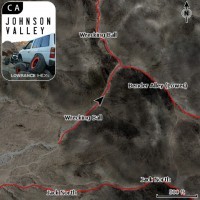
Johnson Valley - Lowrance Off Road GPS Trail Map
Experience the exhilarating off-road terrain of Johnson Valley, ..
$99.99
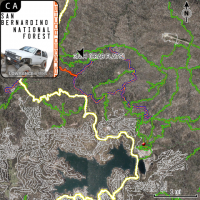
San Bernardino National Forest - Lowrance Off Road GPS Map
The San Bernardino National Forest Lowrance GPS OHV GPS map incl..
$99.99
Guide to Arizona - Lowrance Off Road GPS Map
This SD card includes high definition aerial imagery of trails f..
$119.99
Tags: topo, insight, hd, card, cards, lowrance, gps map
Nissan Customers See Below:
Since 2006, Rugged Rocks Off Road has been dedicated to providing top-quality Nissan 4x4 parts and accessories, supporting the nissan off-road community with passion and commitment. Your support has been instrumental in my journey, and I have been honored to be a part of your adventures. After much consideration, I have decided to close the sale of Nissan parts at Rugged Rocks Off Road to focus on developing advanced mapping products through Rugged Routes at ruggedroutes.com. This direction aims to enhance your off-road experiences with innovative off-road mapping solutions for wide varietey of motorsport vehicles. Exisiting orders will be filled. For new Nissan parts enquiries, please contact Shadow Wolf Mfg at: https://shadowwolfmfg.com/
It has truely been a great journey as an integral part of my adult life for nearly 20 years, has shaped me as an individual, and introduced me many new friends. Moving on has been a heavy and emotional decision that should have probably been made years ago to support a healthier lifestyle. Thanks again for all the suport over the years, it's been a ride.
See you on the trail,
Steven Lutz
Rugged Routes product development is currently a high priority, and therefore enquiry e-mails are delayed. For urgent orders and tight deadlines, please call 909-547-4651 or schedule a meeting here: Schedule Meeting.
Featured
Lowrance Elite FS-7 Baja Bundle, Multifunction Off Road GPS
Compact, Powerful Navigation with Baja Enhancements and Extensiv..
$978.99
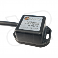
UTV Infrared Belt Temp Gauge, Sensor for Lowrance GPS
UTV Belt Temp Gauge on Lowrance GPS Units Keep your UTV's..
$239.99
Baja Peninsula, Mexico - Lowrance Off Road GPS Map
Baja California, Mexico GPS Map for Lowrance Off Road GPS: This ..
$149.99
Johnson Valley - Lowrance Off Road GPS Trail Map
Experience the exhilarating off-road terrain of Johnson Valley, ..
$99.99
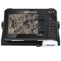
Lowrance HDS-7 Live Baja Bundle, Multifunction Off Road GPS
*Shown with Ocotillo Wells GPS Map, Not Included* *Marine..
$1,399.00
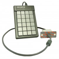
Trailmark - Race Note Keypad Interface by Rugged Routes
To be contacted when available, Enter E-mail Address Below ..
$799.99
Arizona Strip / Grand Canyon - Lowrance Off Road GPS Map
Rugged Routes GPS maps are beyond average. With added data in ma..
$99.99
Glamis Dunes - Lowrance Off Road GPS Map
Experience the thrill of off-roading in Glamis Dunes, California..
$99.99
Lowrance HDS-9 Pro Baja Bundle, Multifunction Off Road GPS
Discover the Ultimate Off-Road Navigation Experience with the Lo..
$2,378.99
Lowrance GPS Engine Data Adapter
*Likely to come Late 2023*Retail Price Likely to be $349To be co..
$349.00
Stoddard Wells, CA - Lowrance Off Road GPS Map
Explore the Stoddard Wells OHV Area located in Barstow, CA, with..
$99.99
Ocotillo Wells - Lowrance Off Road GPS Map
Discover the thrill of off-roading in California's Ocotillo Well..
$99.99
Lowrance HDS-10 Pro Baja Bundle, Multifunction Off Road GPS
Discover the Ultimate Off-Road Navigation Experience with the Lo..
$2,878.99
Lowrance Naviop Loop S - Power Distribution & Digital Switching
Rugged and Reliable Wiring Solution for OHV EnthusiastsExperienc..
$999.00
San Bernardino National Forest - Lowrance Off Road GPS Map
The San Bernardino National Forest Lowrance GPS OHV GPS map incl..
$99.99
USGS Topo - Lowrance Off Road GPS Maps
Introducing our USGS Topo GPS Map for Lowrance off-road GPS devi..
$149.99

