For urgent orders and tight deadlines, please call 909-547-4651.
Thank you,
-Steven
Get the comprehensive Getting Started Guide:
*Available within Lower 48 States Only*
*Satellite Imagery Only, no added roads*
*Payment stays as pending transaction for up to 30 days or until your SD Card Ships*
*Compatilbe with HDS Gen2 or newer HDS Units or Elite Ti or newer Elite Units.
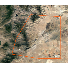
Upload your custom boundary for the area you wish to have satellite Imagery map for.
Boundary files can be created with the Desktop version of Google Earth Pro (Which is free and can be downloaded here: https://www.google.com/earth/versions/ ) and must be submitted as KML or KML files containing one square polygon. Make sure to check your selected Area Size measured in Square Miles as Pictured Above.
Custom Satellite Imagery Lowrance Off Road GPS Maps
- Brand: Rugged Routes
- Product Code: RR-LOW-CUSTOM
- Availability: Available
-
$380.00
Available Options
Tags: off road maps, gps map


